
I am most alive among the tall trees…
This post contains affiliate links…
The forests of the Santa Cruz call to me like no other place. The cool breeze fills my lungs with the smell of pine needles and the aroma of broad-leafed trees. Flowers bloom in the understory wherever a gap in the canopy begets a pool of light. Wood rose, violets, and redwood sorrel peek from the shade. While lupin, monkey-flower, and pink honeysuckle bathe in sunlight.
Hiking these mountains delights the senses. And it’s been my dream to wander in them for days at a time. And this past week, my dream came true…
The Santa Cruz Mountains
The Santa Cruz Mountains are part of the Pacific Coast Ranges that extend along the west coast of North America from Alaska all the way into northern Mexico. The Santa Cruz section stretches from San Francisco southward to Salinas.
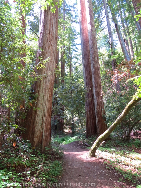
Where I live, the mountains form a roughly 3,000-foot-high ridge that separates the Pacific Ocean from San Francisco Bay. The moist ocean-facing slopes are home to coast redwoods, the tallest trees on our planet. While the higher slopes are chaparral. Dry-adapted plants like Manzanita, Madrone, and Coyote brush jut from sandstone escarpments. Between is oak forest filled with Tanoak and Douglas fir.
With such varied ecosystems, the Santa Cruz harbors amazing plants and animals. It’s also filled with hikers, mountain bikers, trail runners, birders, rock climbers, and just about every form of outdoor recreation imaginable. The price of paradise is that it’s sometimes hard to find solitude in the hills.
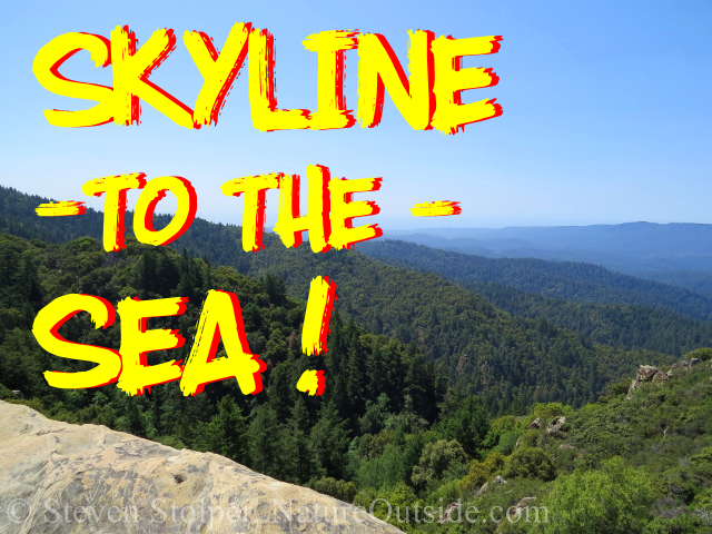
Skyline to the Sea
The most famous hike in the Santa Cruz Mountains is the Skyline to the Sea trail. It begins along the spine of the mountains and runs 33 miles from Castle Rock State park through Big Basin State Park. It finishes triumphantly at the Pacific Ocean at the sands of Waddell State Beach.
It’s too long for most people to hike in a single day. So there are trail camps along the way where foot-weary trampers can spend a peaceful night in the wilderness.
What makes the hike difficult is the car shuttle needed from the far end back to the trailhead. Unless you are traveling with a group, you need devoted friends to pick you up at the ocean. Because of the involved logistics, I’ve never found a good time to make the journey.
CASPBA
But that changed this summer because of CASPBA.
California State Parks wants to encourage backpacking in the Santa Cruz Mountains. So they’re offering ranger-led backpacking trips. The division of the Parks System is known as California State Parks Backpacking Adventures (CASPBA). Their tagline is:
Travel from spectacular ridgelines, through old growth redwood forests, to sandy shores with our knowledgeable team of backcountry naturalists. We will share the secrets of this precious wilderness and give you a window into the lives of the people who lived here for thousands of years.
– CASPBA
The program is modeled after the National Park Service’s High Sierra Loop. In fact, the CASPBA staff even mentioned the ranger-guide who led my 54-mile walk through Yosemite’s high country.
For me, it’s a golden opportunity. I can hike with knowledgeable guides, enjoy the camaraderie of a group, and let State Parks handle the car shuttle and permits. All for an affordable price!
I jump at the chance and pack my rucksack.
We meet our guides at a pre-trip meeting two weeks before the hike. I attend in-person at Henry Cowell State Park. But several hikers from out of the area join by video conference using their computers.
At the meeting we meet Rangers Jeremy and Brandon, our guides for the trip. They explain that we will hike 10 miles the first day, 10 miles the second day, 6 miles the third day, and finally 7 miles to the beach.
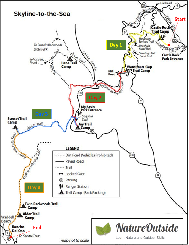
Schematic view of our route. This is a modified California State Parks drawing.
They also make an incredible offer: If we bring dehydrated meals, they will provide the hot water. This means I do not need to carry a stove, pots, cooking utensils, or even plates! I can carry a pack around 30 lbs. including food and water!
Despite my disdain for dehydrated food, I eagerly accept their offer. The chance to carry a light pack is too enticing.
The rangers also give us handouts and answer all our questions about the hike and equipment we need. Their enthusiasm is contagious and I leave the meeting counting the days until the trip starts.
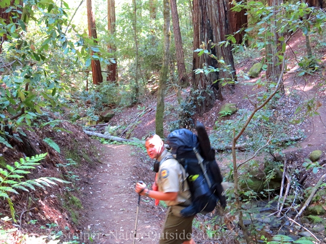
Day 1: Castle Rock to Waterman Gap
We meet the rangers at the beach. It may seem strange to meet at the end of a hike, but it allows us to park our cars at our destination. When we return three days later, our cars will be waiting to carry us home.
It’s not a particularly cold morning. But strong gusts whip off the ocean. I instinctively turn my back to the wind as we load our packs onto vans that shuttle us to the trailhead. The blowing sand patters against the back of my rain jacket, which doubles as my windbreaker. The boom and hiss of the waves lend gravity to the start of our journey.
Conditions cannot be more different at the trailhead. Our vans deposit us on a warm, sunny ridge teeming with dry-adapted plants. We shed layers and apply sunscreen as we don our packs.
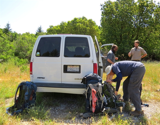
We grab our gear from the van. Our hike starts on a ridge in Castle Rock State Park.
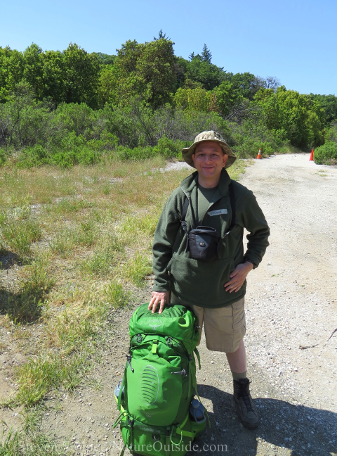
Ready to hike!
Wolf Howl
Before we set out, Rangers Jeremy and Brandon gather us together for a lusty wolf howl. And thus announcing our intentions, we set off down the trail!
The first stage of our hike is through mixed black oak forest. The Black oak acorn was prized for food by Native Californians. But few of the trees remain due to habitat destruction. It’s a treat to walk beneath the open canopy and admire the wildflowers that bloom among the grasses.
Goat Rock
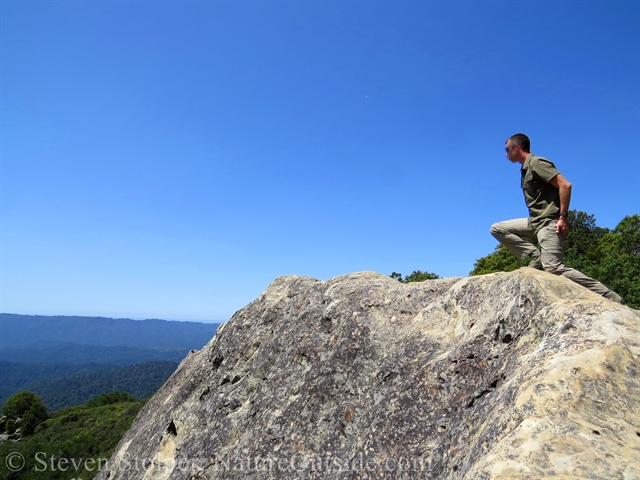
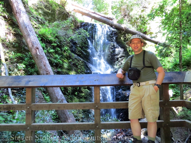
The forest trail stops at an amazing site. A bastion of sandstone rises above us! I know from experience that this is Goat Rock. We are on the uphill side, and a 20-foot scramble takes us to the top.
Goat Rock is popular with local climbers. And many Bay Area residents learned to climb on its downhill face. You see, the downhill face towers 80 feet above the surrounding terrain.
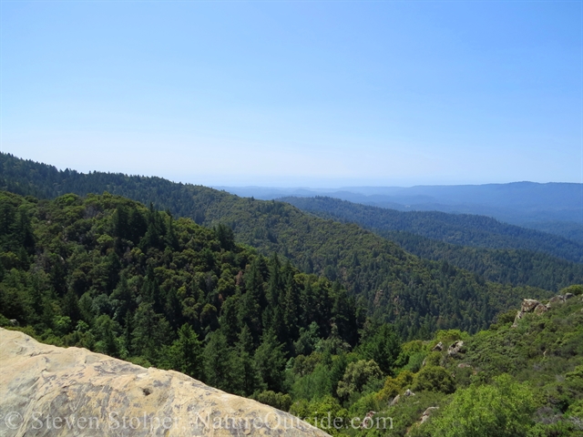
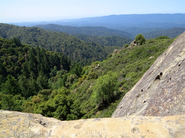
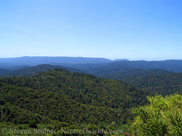
But for me, its allure is the panoramic view from the top. On a clear day, you can see 40 miles south to Monterey Bay. Today it will show us the Pacific Ocean, our destination, and the intervening mountains we must traverse to get there.
Despite my fear of heights, I make the short scramble up it’s back face. The view is astounding.
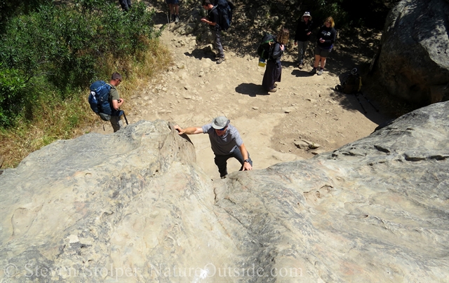
Scrambling up the back side of Goat Rock
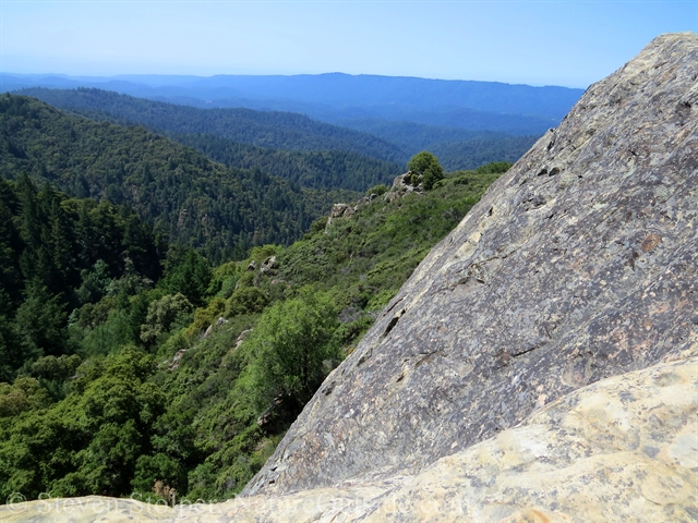
The view from Goat Rock
Looking south, you can just make out the ocean
This is the direction we must go
Looking out at our route
Hike Through History
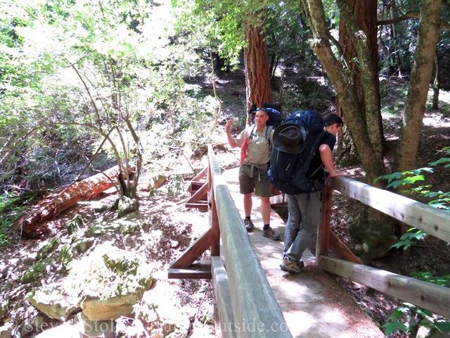
Our route through the mountains can be found on the Castle Rock State Park and Big Basin Redwoods State Park trail maps. Rangers Jeremy and Brandon mailed maps to us before the trip.
But even knowing the terrain as I do, there are a few surprises. Ranger Jeremy points out ruts worn away in the stony trail. These are from wagons and may be 150 years old. I have passed them dozens of times while day-hiking and never gave them much thought. I assumed a trail crew made the marks when the trail was built.
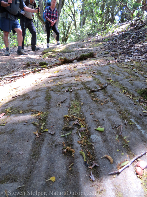
Wagon ruts in the trail
Ranger Brandon explains the ruts on the trail
Jeremy and Brandon also point out another feature I missed – a huge oak tree that’s a hybrid of two common species.
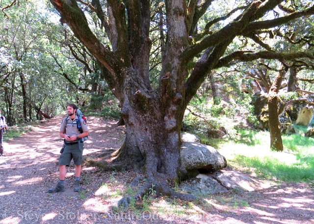
This gorgeous oak tree is a hybrid of two species
From the ridge we can see the view ahead. For some of us, it must be daunting. But I have day-hiked throughout these mountains. So I am able to discern landmarks and imagine the route we must follow.
The view ahead. The ocean is on the horizon.
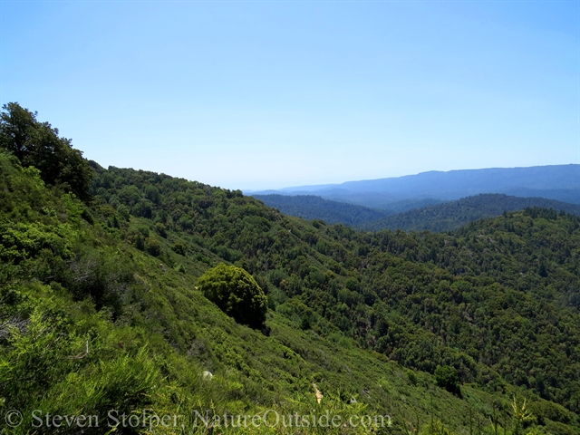
The ridge we are hiking on
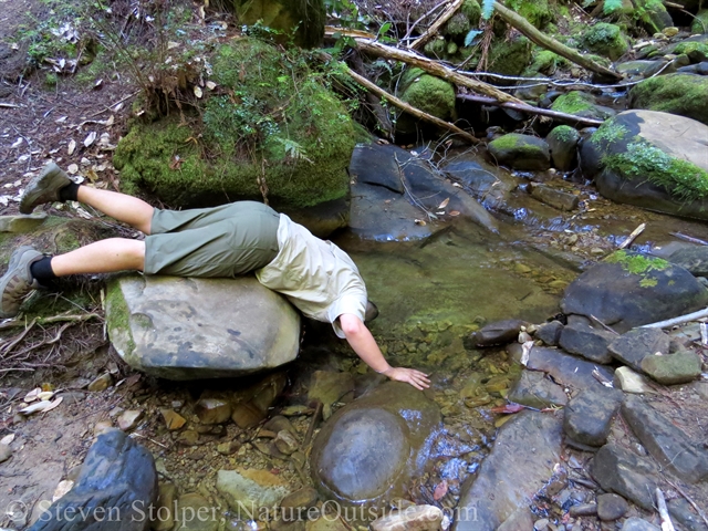
The Water Ostrich
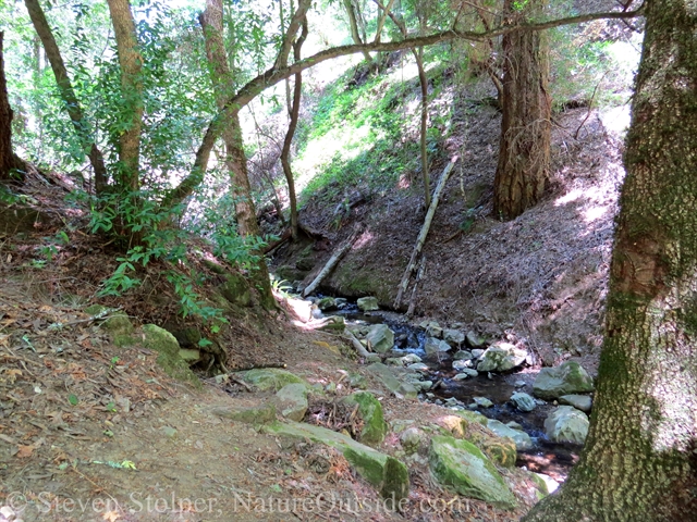
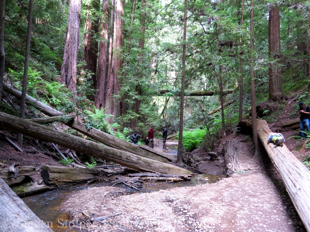
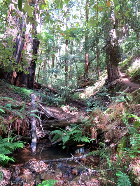
Eventually, the trail turns west and we descend deep into the forest. As we drop, the air becomes less arid. Until finally, we reach the headwaters of the San Lorenzo River. The river flows southward through the San Lorenzo Valley before emptying into Monterey Bay and the Pacific Ocean. It’s amazing that this impressive river begins as just a trickle.
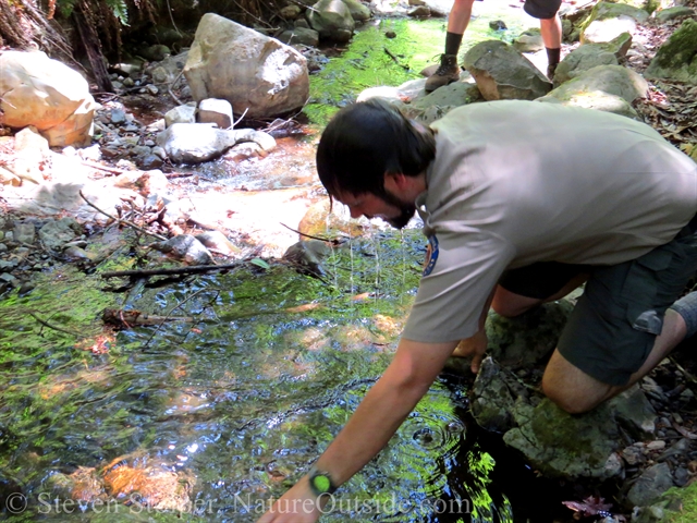
Ranger Jeremy stops the group and says it’s a good time for a “Water Ostrich.” My antenna goes up immediately. I’m not familiar with this exotic bird.
But to our delight it’s not a bird at all! Instead Ranger Jeremy seeks refreshment from the heat in the cool headwaters of the San Lorenzo. To a chorus of cheers, Rangers Jeremy and Brandon demonstrate the Water Ostrich. Of course! What does an ostrich do when it’s frightened?
Ranger Jeremy calls a halt
The headwaters of the San Lorenzo
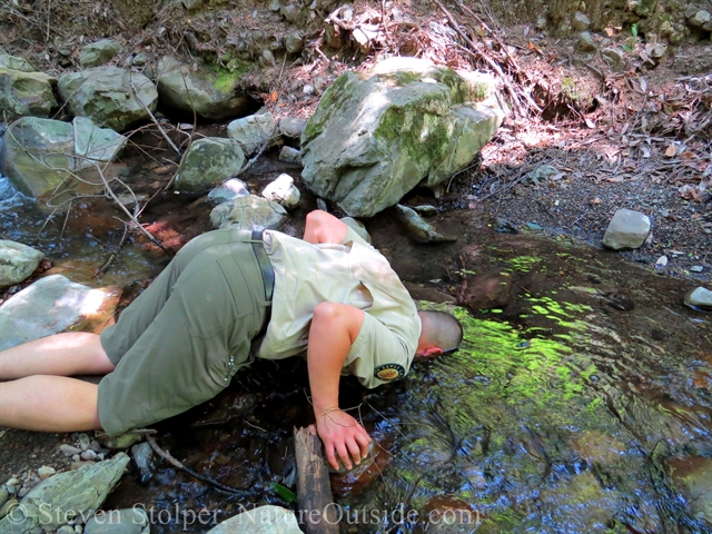
Ranger Jeremy demonstrates the Water Ostrich
Others rush to try
Thank you may I have another…
Ranger Brandon gets into the act
Refreshing!
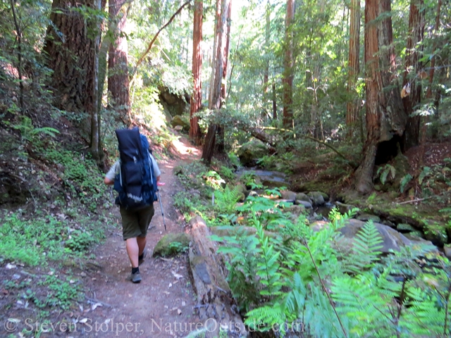
Mystery Cars
We continue our hike underneath the trees. Wood rose (Rosa woodsii) peeks at us from the side of the trail.
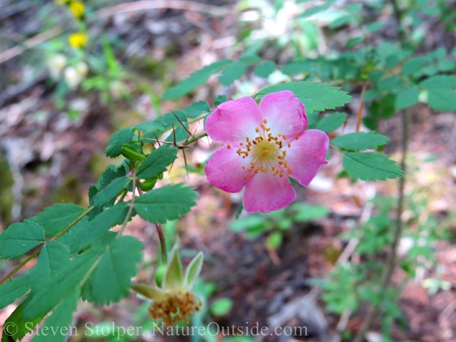
Wood rose in bloom
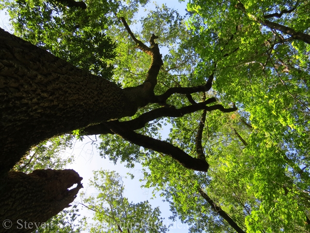
The canopy above
Paralleling our route, Highway 9 travels over the crest of the mountains and down to the sea. We will need to cross it miles ahead. But for this stretch we hike parallel to the road. We can’t see it, but we hear the occasional car in the distance.
Over the years there have been many accidents on this curvy road. Cars rain over the edge like water droplets shaken from a wet dog. I’ve hiked this area before and have found the wrecks of many cars from different eras. From the 40s, 50s, and 60s – each has a story. What happened in the moments leading to the fateful wreck? Did someone have one drink too many? Did they lose control on a dark and rainy night? I wonder about the health of the occupants after plunging over the steep ravine.
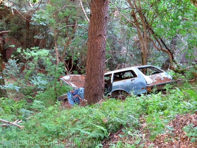
A more recent wreck. It looks like the station wagon my neighbors used to shuttle their kids to school in the ‘70s.
Waterman Gap Trail Camp
We pull off the trail in late afternoon.
I’m pleasantly surprised by the trail camp. Pine needles carpet the campsites beneath the forest’s comfortable shade. We walk through the dappled light to two campsites at the far end of the camp.
I wrinkle my nose as we pass the concrete structure that houses the pit toilet. But I needn’t have worried. When I use it later it is clean and the odors have disappeared.
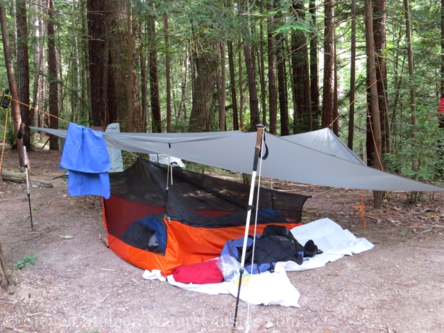
I pitch my tent at the edge of a redwood grove. It’s an ideal setting and I feel comfortable in these woods. The wind whispers through the trees, hinting at greater gusts above. But the forest provides a cozy shelter.
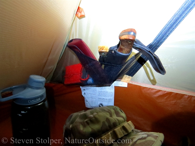
I unpack my gear. There’s not much of it. Ray Mears, the famous bushcraft and survival instructor, said “Keep it simple – it’s easy to carry too many gadgets.” I agree. And nothing encourages minimalism like carrying your house on your back.
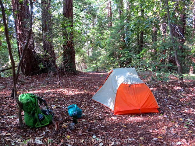
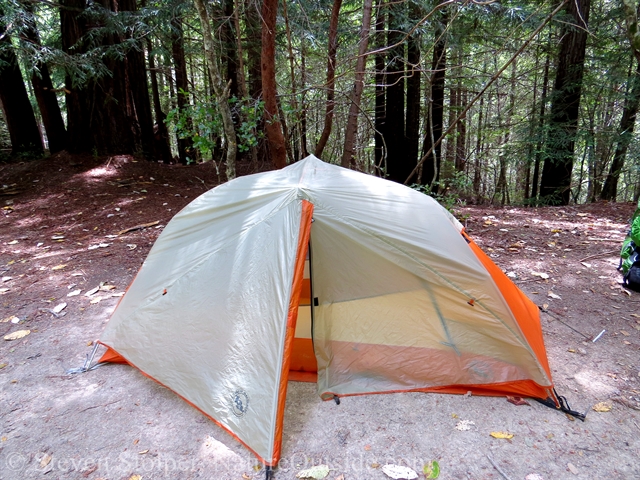
My tent, backpack, food bag, water bottles, and metal cup. The metal cup is the only eating surface I brought on the trip.
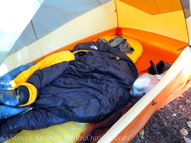
Inside my tent are my sleeping bag and sleeping mat
The first order of business is to get the roof up. Although the weather is beautiful, you never know when a storm may come along. My tent is a one-person ultralight tent. It’s not as luxurious or as easy to set up as the two-person tent I use for car camping. However, it’s a fraction of the size and weight.
Since I don’t use the tent often, I practiced pitching it before the trip. This allowed me to make sure nothing was broken or missing. I took time to commit the steps to memory so I could set it up in the dark if I needed. All that practice paid off – when I set up the tent I made the same mistakes I made during practice. 🙂
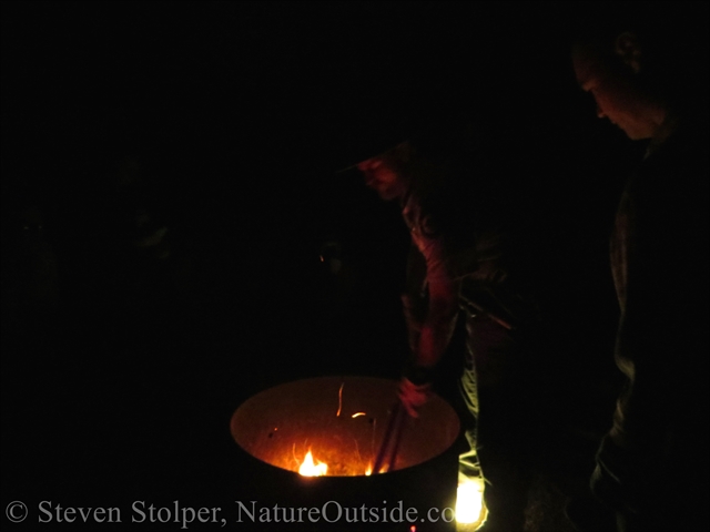
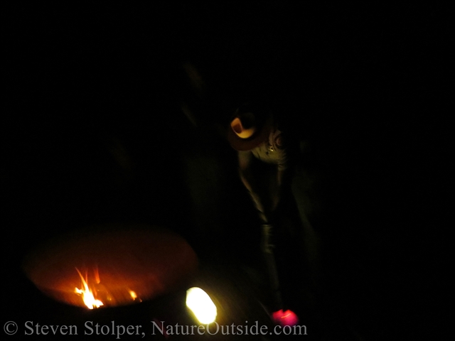
Next on the agenda is dinner. The rangers provide the hot water, which I use to reconstitute my dinner of dehydrated hamburger meat with mayo, mustard, ketchup, and relish wrapped in a flour tortilla. That’s 690 calories of deliciousness. Yum!
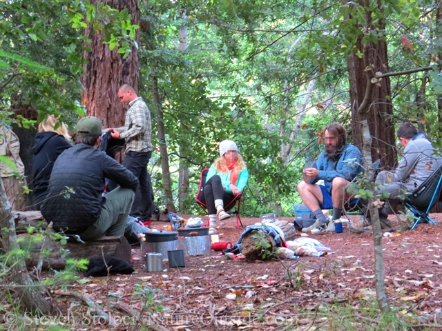
Assembling for dinner
Heating water for dinner
After dinner, Rangers Jeremy and Brandon brew pine needle tea made from Douglas Fir needles. Most pine needles are edible. And Douglas Fir is my favorite.
After dinner, I sip hot chocolate as a visiting ranger speaks to us about the role of fire ecology in the Santa Cruz Mountains.
As darkness falls, I retire to my tent to sleep.
A small pocket stores anything I need if I get up in the middle of the night
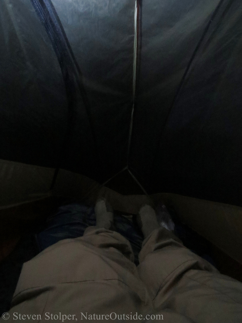
Getting into clean sleepwear for bed
Goodnight.
DAY 2: Waterman Gap to Big Basin
The plan is to wake at 7:00 am with breakfast at 8:00 am. But most of us wake with the sun a half-hour earlier. At 7:00 am on the dot, Jeremy strolls between the tents gently strumming his backpacking guitar. He plays a mellow Pink Floyd tune. It’s the perfect melody for this tranquil setting.
I’ve been part of other groups where you’re awakened every morning by someone banging on a pot or pan. This is infinitely better!
My breakfast is simple. Kashi Go-Lean granola cereal and powdered milk. A Kind bar adds some extra calories. I usually don’t eat much for breakfast. But this meal gives me the energy to get out on the trail.
Breakfast. Rangers Jeremy and Brandon provisioned water bottles as an alternative to the heavily chlorinated water at the trail camp. Much appreciated.
Snake
We hit the trail and make our first of two highway crossings. First, we cross Hwy 9. Then we traverse Hwy 236, which leads into Big Basin State Park. I’m amazed at the distance we covered since the start of our trip. But it occurs to me that the trail must cut a straighter path through the mountains than the highway.
These highway crossings mark an important point. We’ve entered the Big Basin watershed. We’re now in Big Basin State Park, where I lead outdoor programs as a naturalist.
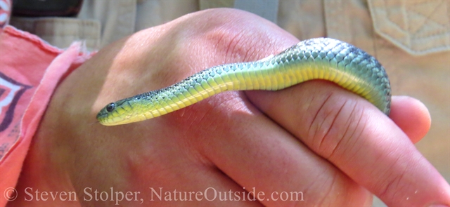
Now under the redwoods, we happen upon a small coast garter snake. Ranger Jeremy scoops up the harmless reptile. Unable to prevent capture, the snake deploys its remaining defense – it musks him! The snake emits the musk from its cloaca. And it often comes with a bonus dose of urine and feces.
Despite this minor discomfort, Ranger Jeremy acquaints us with the creature.
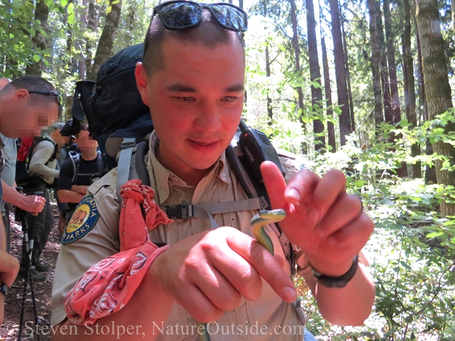
Ranger Jeremy captures a small Coast garter snake
Say “Cheese!”
A moment to Appreciate
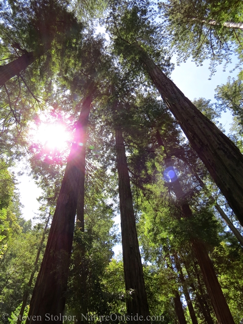
As we hike, I often glance up at the canopy to appreciate the enormity of the redwood forest. When we stop for lunch, Jeremy suggests we lay on our backs for ten minutes and look up into the canopy. The group goes silent as we lay on the soft bed of redwood needles. Slowly, absent our disturbance, the birds return and begin to sing. Squirrels resume their foraging in the brush. And we hear the creaking as the big trees sway in the breeze. It’s a magnificent moment. And I’m glad we took this short break to stay awhile.
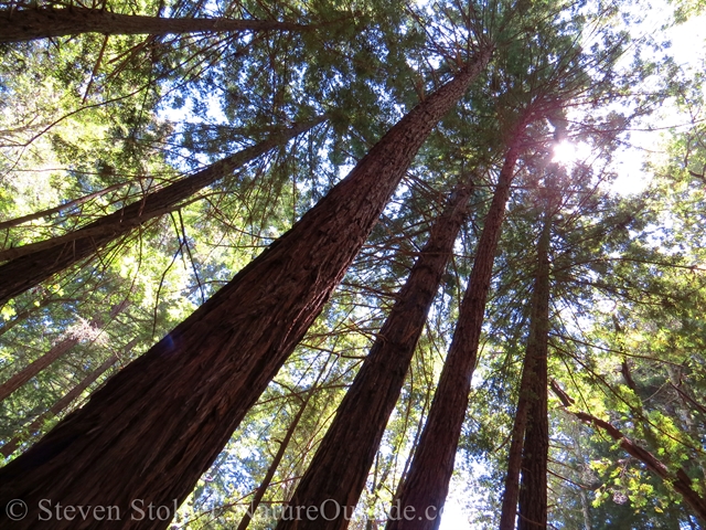
Our lunch spot canopy
The trees above our sit spot
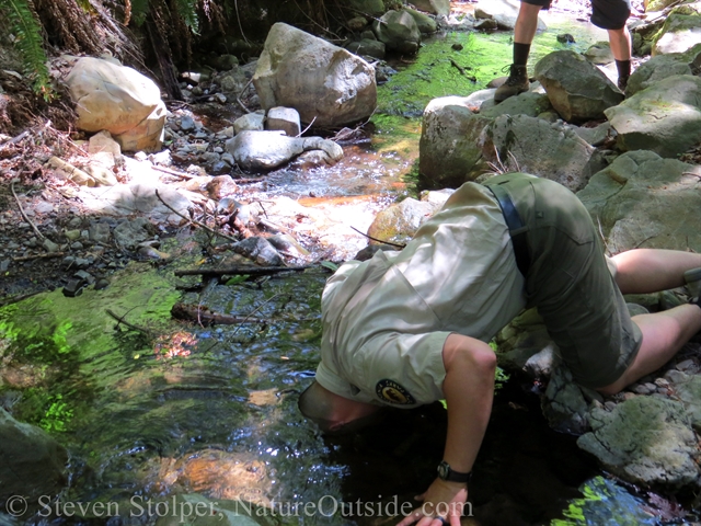
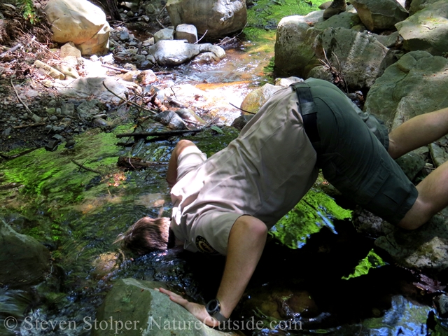
Another Ostrich
It’s back on the trail, and soon there’s another opportunity for a Water Ostrich. Ranger Jeremy is not one to let an opportunity pass by.
On the trail
Water Ostrich. Ranger Jeremy goes off the deep end.
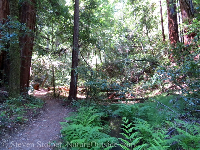
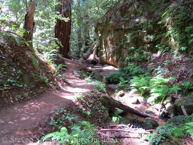
Notice how we’ve descended out of the drier tanoak forest into lush redwood forest
Jay Camp
We reach Big Basin Park headquarters and I share a secret with my fellow backpackers. The general store sells soft-serve ice cream cones. It’s not really “roughing it.” But I assure you, cold ice cream on a hot day does not detract from the wilderness experience. And I always try to use natural resources I find along the trail. In this case, it’s a “wilderness ice cream cone.” 🙂
We continue our hike to Jay Camp, a trail camp located about a half-mile beyond headquarters.
The Unwanted Visitor
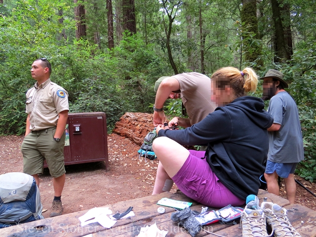
Upon pitching our tents, we learn that one of our hikers has an unwanted passenger. It’s a Western black-legged tick. And it’s attached to her abdomen.
As I dig in my first aid kit for my tick key, the rangers use tweezers to extract the arachnid. Ranger Jeremy gives a slight clockwise rotation as he pulls. But the tick puts up a fight. With a little patience, Jeremey removes the blood sucker from our hiker’s stretched skin.
I give silent thanks that I treated my clothing with permethrin before the trip.
We use my tick ID card to identify it. The hiker plans to send the tick for free Lyme testing. Although I visited the website and they appear to have discontinued the service because they are so overwhelmed with requests. Fortunately, the tick wasn’t attached for very long. So the odds that it transmitted a disease are small.
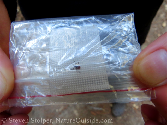
We save the tick for later identification and analysis. The type of tick gives clues as to what diseases it may carry.
Night Program at Jay Camp
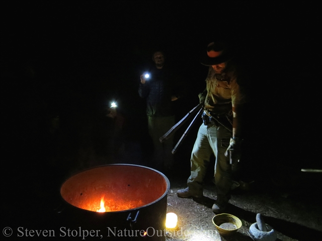
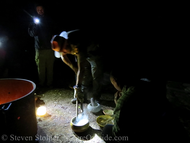
As evening falls we make a small campfire in the fire ring. And to my delight, I learn that Ranger Alex will stop by after dinner to present an interpretive program on traditional food preparation.
Ranger Alex has a keen interest in the traditional skills of the Ohlone peoples, who inhabited this region before Europeans arrived in California. And he’s learned much from their descendants, the Amah Mutsun Tribal Band.
Ranger Alex walks us through the steps for the preparation of California Brome grass (Bromus carinatus): Harvest the seed, winnow, parch, grind, and cook.
He starts by demonstrating how to make fire with a hand-drill. He uses an elderberry spindle on a California buckeye hearth board. On this occasion, he gets plenty of smoke but no ember. Ranger Alex is a bit under the weather, and he already has blisters on his hands from making fire earlier in the week. I’ve had blisters from using a hand drill and I know how they hurt.
The ancient inhabitants of Big Basin made fire by friction as part of their daily lives. In fact, their lives depended upon their ability to make fire. Like Ranger Alex, I only practice the skill occasionally. So I don’t begrudge him the lack of ember.
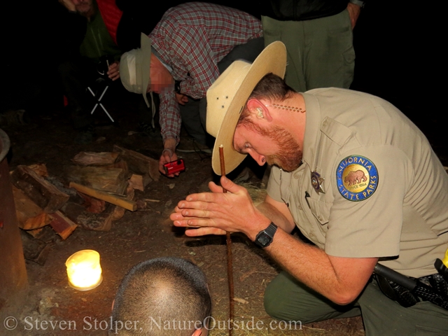
Ranger Alex preparing to use the hand drill
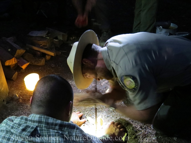
Hand’s flying, Ranger Alex goes for the ember
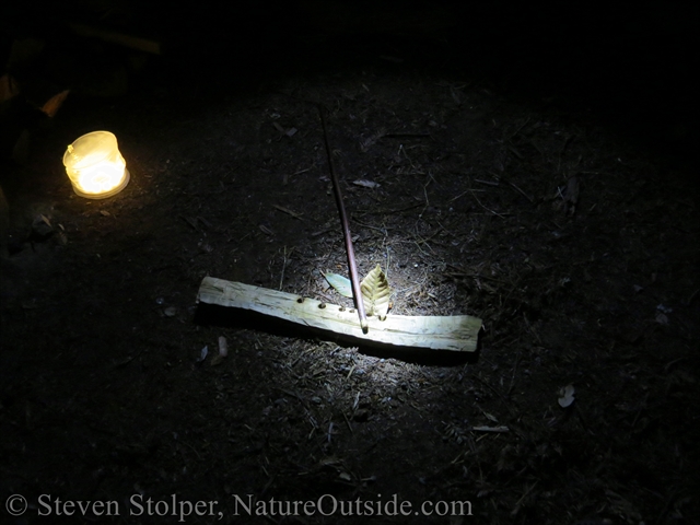
Hand drill – Elderberry spindle with California buckeye hearth board
Ranger Alex walks us through the steps for harvesting and processing the seed. He demonstrates each step.
Ranger Alex demonstrates harvesting grass seed using modern stand-ins for seed-beater and basket
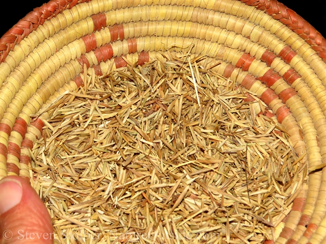
California Brome grass seed
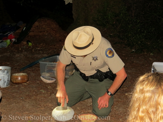
De-husking seed using a mortar and pestle
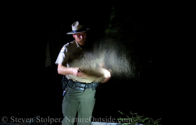
Winnowing with a basket discards the husks and keeps the seed
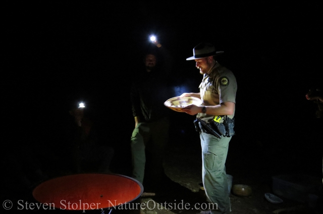
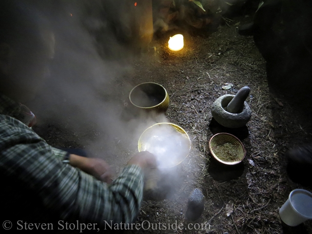
Ranger Alex parches the seed by tossing it in a basket with coals from the fire. This hardens the seed to make it easier to process.
Parching seed
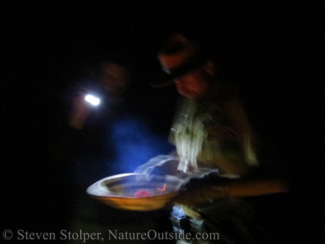
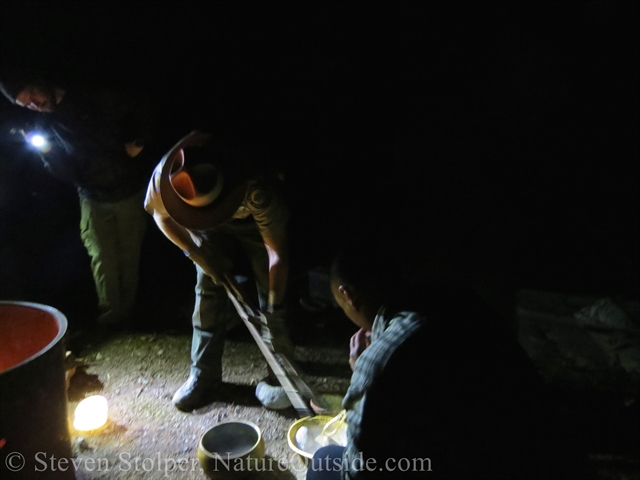
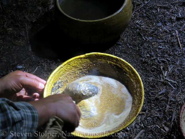
We place ground seed and water into a pre-soaked watertight basket. Ranger Alex cooks the grain in front of us using hot volcanic rocks we warmed on the fire for two hours.
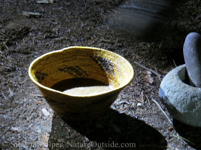
Ground seed in water inside a pre-soaked water-tight basket
Ranger Jeremy helps by using a stirrer made from bent willow
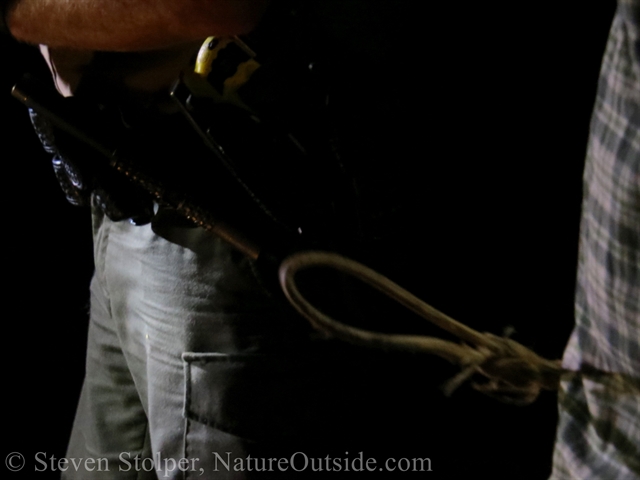
Ranger Alex seizes a rock from the fire using wood branches as tongs
The rocks are hot!
Ranger Alex dunks a rock into a basket of water to remove the ash from the fire
Cleaning ash from the hot rock
Ranger Alex transfers the clean rock to the cooking basket
Cooking with hot rocks. It’s important to keep them moving to heat the food evenly and prevent burning the basket.
We continue to add rocks and stir. When rocks cool, we remove them from the basket.
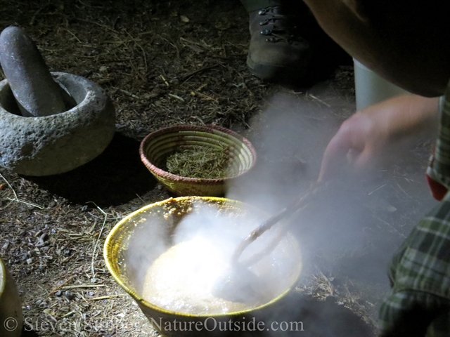
Finally, we reach a rollicking boil
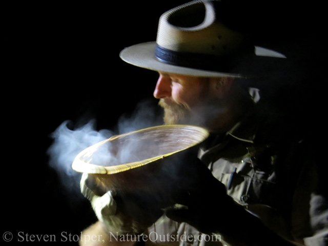
Dinner is served!
After sampling the hot food, we thank Ranger Alex and retire to our tents for the night.
DAY 3: Jay Camp to Sunset Camp
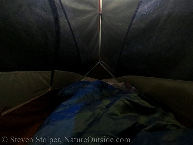
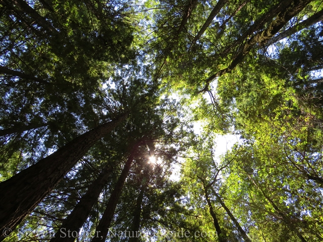
I awake to the quiet patter of raindrops falling on my tent. But it isn’t quite rain. A heavy mist fills the forest and droplets fall from the trees above. The mist is how their treetops survive hundreds of feet above the forest floor.
It’s amazing to wake underneath immortal redwoods. The trees are thousands of years old, and their roots touch ancient underworlds that once saw the light of day.
I walk through the hushed forest to the restrooms. Jay Camp has flush toilets and sinks. An incredible luxury! And State Parks always keeps the facilities clean and well-maintained. My pack is lighter by several quarters I lent to other members of our party to use the pay showers. I eschewed the showers myself. Some things are a little too much for a backpacking trip.
Blister Clinic
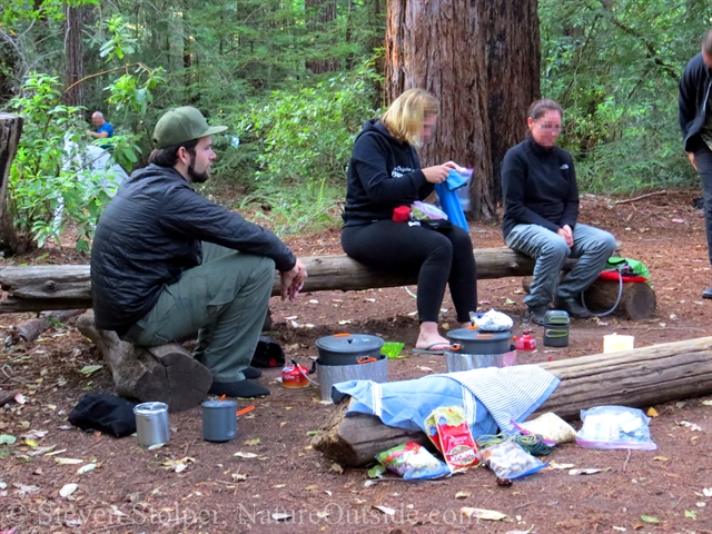
The Rangers agree that the third day is the most trying. Not because of distance – we’re only walking six miles today. But blisters and fatigue begin to catch up to the participants.
Jeremy and Brandon hold a “Blister Clinic” after breakfast. Think of a M*A*S*H unit in miniature. I learn about a host of new products aimed at blister treatment. Their high-tech materials put my moleskin to shame.
Blister clinic before departing camp
Blisters treated, we strike out on the trail. In our haste we forget our signature wolf-howl.
Ranger Pointing
We descend toward the ocean on the park’s famous Sunset Trail. It carries us to the Sunset Trail Camp near the top of two terrific waterfalls.
On the way, Jeremy tells me about a Facebook group called Rangers Pointing at Things. I’m dubious at first. But on second thought, you can find a group for just about everything on Facebook.
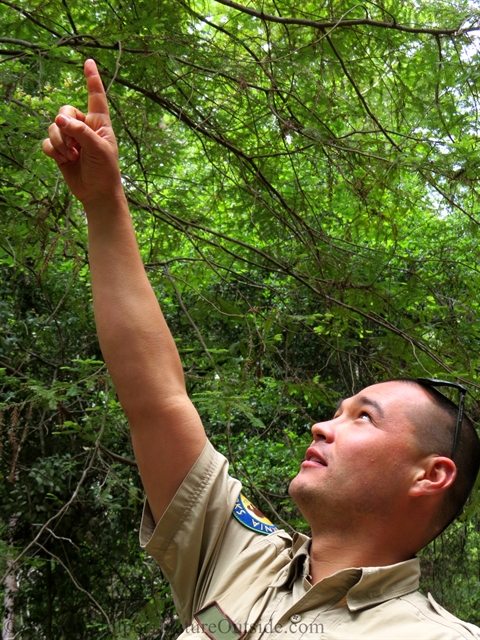
I can’t resist!
Fungus Among Us
As we’re hiking, I see a shelf fungus on a young Douglas Fir. Initially I think it’s an Artist’s Conk (Ganoderma applanatum). This is the one you can draw designs on. It’s white bottom surface can be scratched with a sharp implement and the dark brown tissue underneath shows through. When the fungus dries, the dark lines become permanent.
But it doesn’t quite have the look of an Artits’s Conk. It’s actually a Red-belted polypore (Fomitopsis pinicola). This fungus usually grows on conifers. I can tell this one is young because of its bright orange color. Recent molecular evidence indicates that Fomitopsis pinicola is restricted to Eurasia. So we await a new name for our species in the western United States.
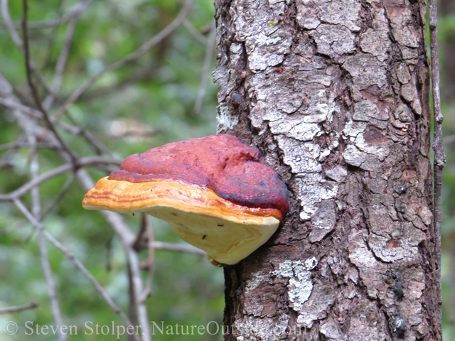
Red-belted polypore
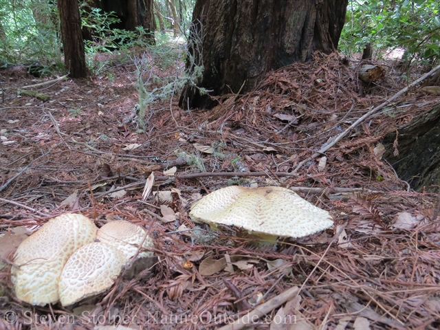
It’s well past the mushroom season. But someone needs to explain it to these fungi.
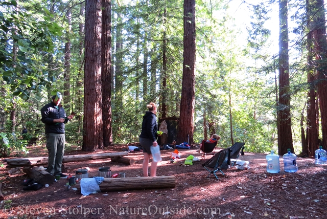
Sunset Trail Camp
We reach Sunset Camp in early afternoon. It’s much nicer than I anticipated. The campsites are far enough back from the main trail to have a wild feel. We site our tents underneath a cluster of Madrone trees. Their naked, red trunks lend atmosphere to our camp.
Once the tent is up, I inflate my sleeping pad and unpack my sleeping bag. I want the bag to loft before bedtime to improve its insulating ability.
Here are some pictures from around camp.
My one-person tent
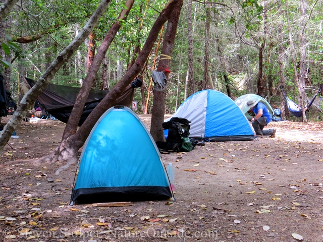
The rest of our camp
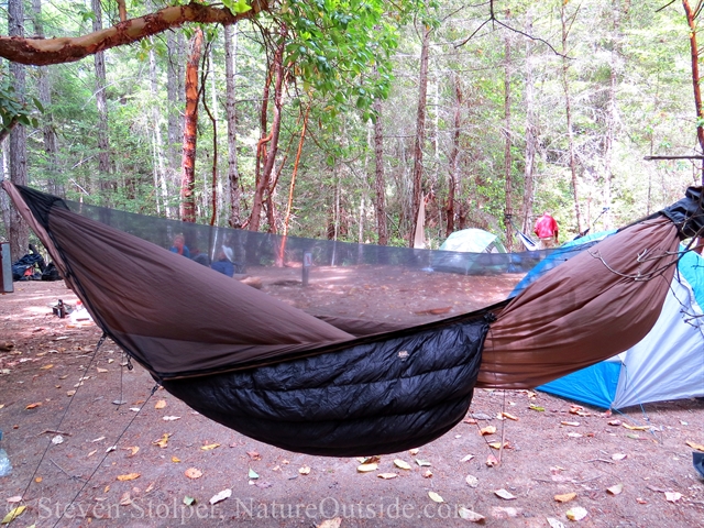
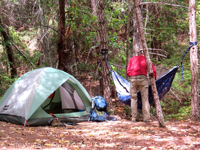
Two in our party brought hammocks. I like the mosquito netting over this one.
Putting up camp
I’m always interested to see other people’s set-ups. This is not a member of our group. But I’m intrigued by the tarp/mosquito shelter combination.
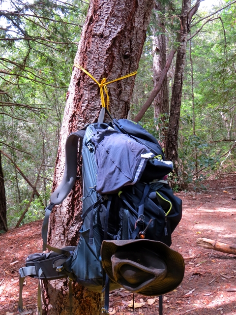
One member of our group was smart enough to bring cordage to hang his pack at a convenient height. I may borrow this idea.
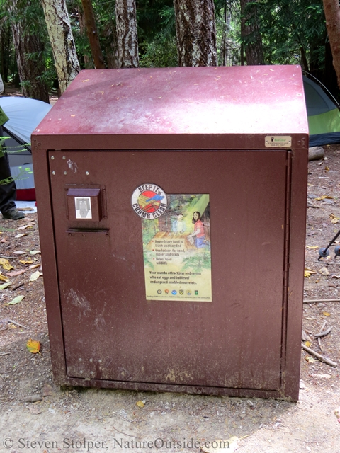
Two of our three trail camps have bear boxes to keep critters away from our food
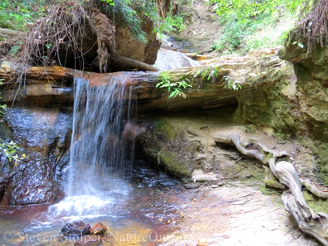
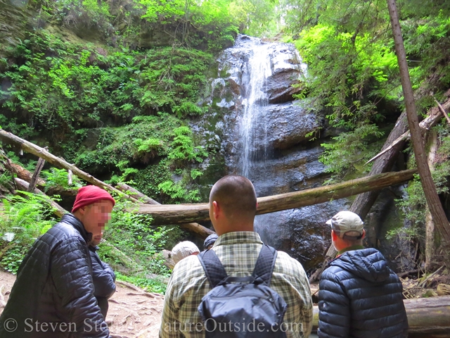
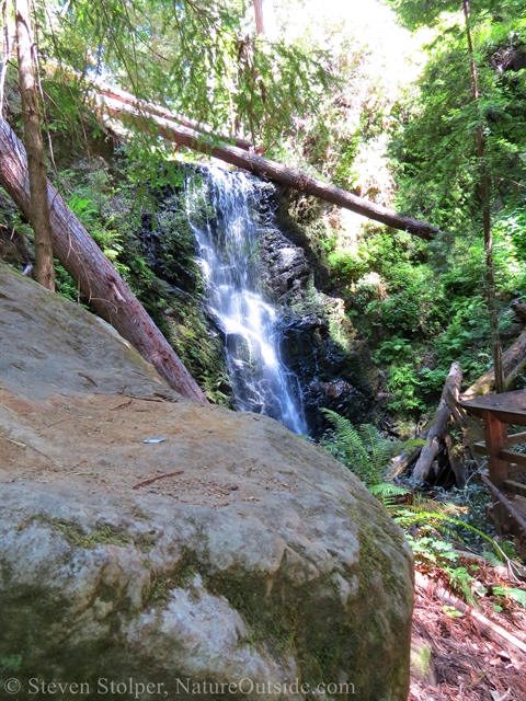
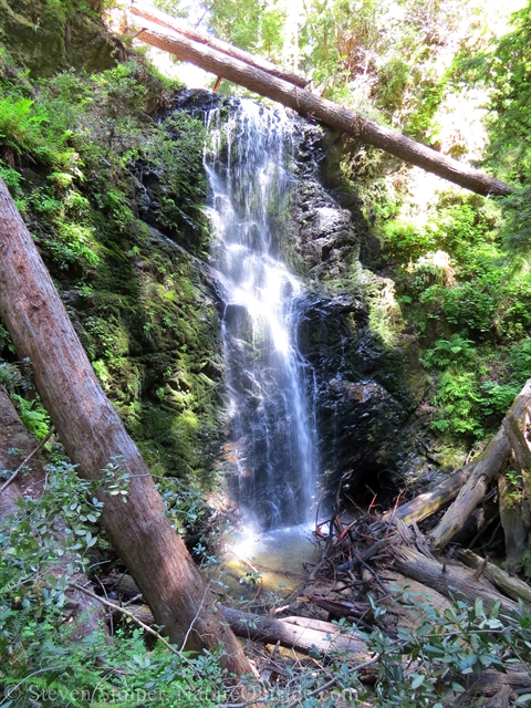
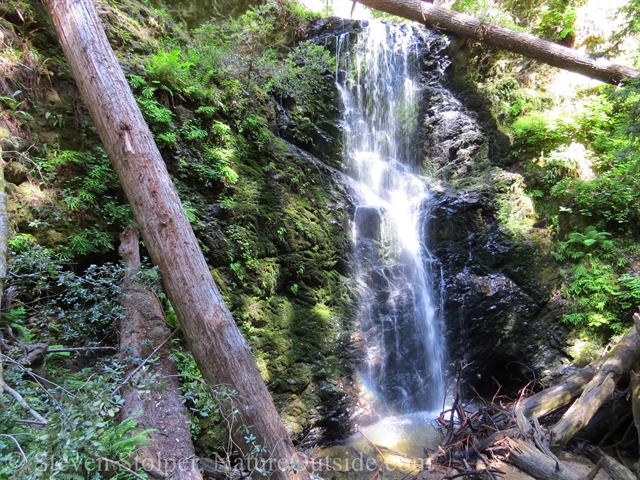
Waterfall Excursion
The plan is to establish camp and visit two nearby waterfalls. We arrive at the first waterfall around 5:00 pm. This is a treat for me. When I pass these falls on day-hikes, it is still early in the day and I’ve got miles to cover to reach headquarters before nightfall. But this is a chance to visit the falls at the end of the day. The light is different. And the day hikers are long gone.
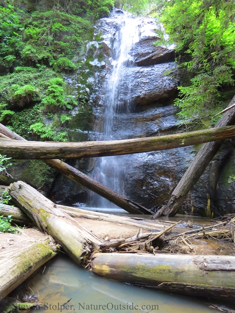
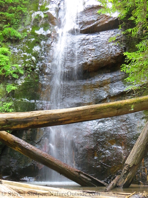
We visit Golden Falls first. It reminds me of an ancient Aztec pyramid partially hidden by the encroaching jungle.
The falls bask in pools of light and shadow. And we enjoy a lazy, peaceful feeling as we gaze upon the spilling water.
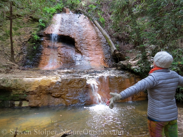
Rejoicing at the base of Golden Falls
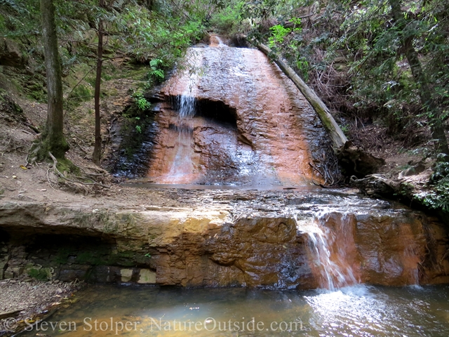
Golden Falls in summer
Golden Falls seen from the trail
Just below Golden Falls is a second cascade
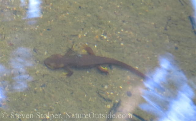
California Newts
In the pools below Golden Falls, Ranger Brandon finds a California Newt (Taricha torosa). Newts are amphibians, living part of their lives in water and part on land. Dipping his hands in the water and mud, Ranger Brandon grabs a newt to tell us more about it.
You need to be cautious when handling newts. Their bright orange color is aposematic. We now know that their skin secretes the deadly neurotoxin, tetrodotoxin. This is the same lethal poison found in pufferfish.
The discovery that these newts are poisonous is a particularly tragic tale. Many years ago, three hunters were found dead in Oregon. Their bodies were discovered around a campfire, and they showed no signs of injury or foul play. Nothing had been stolen.
Searching the campsite, investigators found a dead newt in the bottom of their coffee pot.
The hunters must have arrived at their campsite after dark. When they gathered water from a nearby stream for coffee, they scooped up the toxic amphibian.
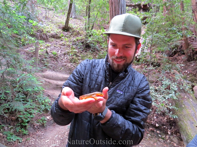
Ranger Brandon and California Newt
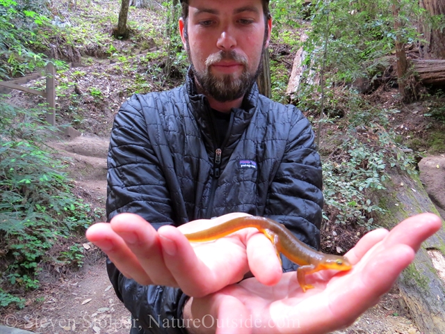
Notice the flat tail. The newt is in its aquatic stage.
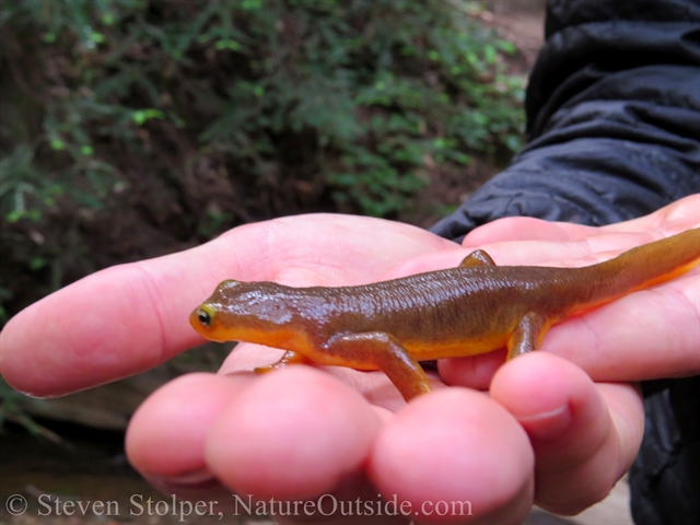
California Newt
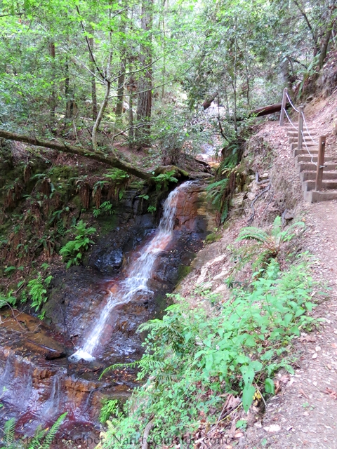
We continue down the trail to Silver Falls. It’s the larger of the two waterfalls. Afterward, we return to camp for dinner.
Day 4: Sunset Camp to the Sea
I rise from bed on our last morning. Sunlight peeks through the canopy, illuminating the walls of my tent. The warning cries of a brazen Stellar’s Jay tell me members of our party are up and about.
After breakfast, we depart on the last day of our journey. It seems to have flown by like the red-tailed hawks we see cruising over the ridges above us. I’m reluctant to leave our campsite. I’ve enjoyed its comfort and the jovial companionship of our party.
But once on the trail we set a good pace as we march to the sea.
Solo hike
One of my favorite moments happens next. Below Silver Falls, Ranger Jeremy calls us together. We’re to hike the next segment of our journey solo. Jeremy dispatches us every two minutes, and I’m lucky enough to go first.
Many people fear hiking alone. But I embrace it. I hear more, see more, and notice more when I’m on my own. I feel connected to my surroundings without distraction from my fellow man.
I force myself to slow my pace. And I meander down the trail, letting my senses drift. At this early hour the forest is still. The brook babbles beside me and I hear the occasional leaf falling from above.
Walking solo down the trail
The forest is still at this early hour
It’s easy to lose oneself in such beautiful surroundings
The stillness is filled by birdsong. It’s the mind-boggling staccato of a Pacific Wren:
I realize the singing bird is in a bush somewhere to my right. Camera in hand, I begin creeping toward the chirping foliage. The autofocus on my camera complains as it hunts between the branches. This picture is the best I can do. Such a small bird produces such amazing sound!
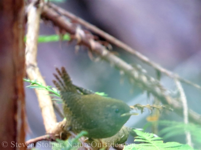
Pacific wren
Further down the trail I hear the mechanical techno-sounds of a Swainson’s Thrush.
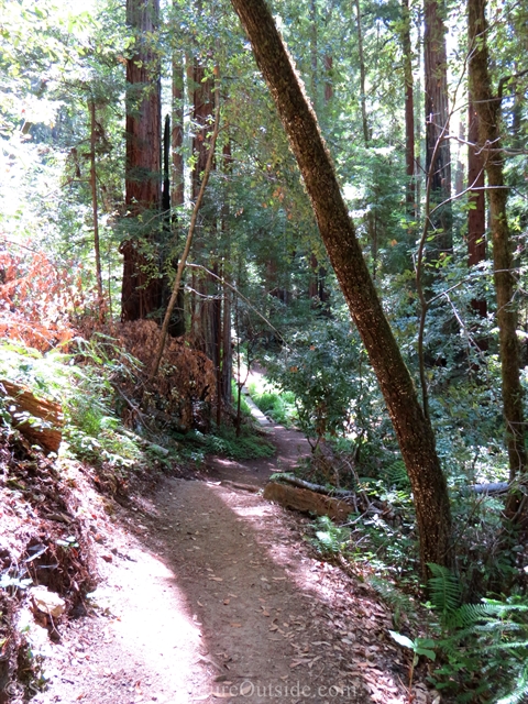
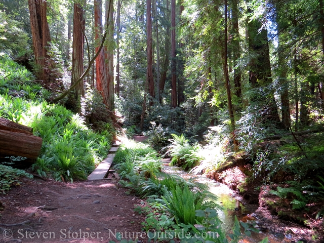
I continue onward. Light shines through breaks in the canopy, creating bright stepping-stones across the trail. There’s a fresh breeze against my cheek and I smell redwood needles and moisture from lush ferns lining the creek.
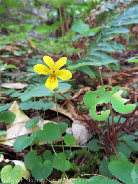
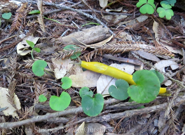
Redwood violet (Viola sempervirens)
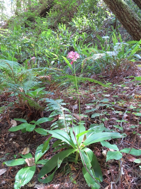
Red clintonia (Clintonia andrewsiana)
I continue my solo hike through the redwoods
The lush redwood forest is a living Eden
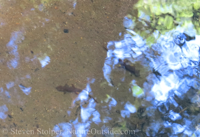
I find a deeper pool and spot California newts hiding in plain sight.
The newts remain motionless at the bottom of the pool
Newts breathe air. But they can hold their breath between 4 – 7 hours. This one has a small fish resting on its back!
I hike onward until I arrive at the top of Berry Creek Falls.
Hiking through the redwood forest
And of course, no hike through redwood forest would be complete without a Banana slug picture!
For a banana slug, this is a modest size
Berry Creek Falls
I’ve written before about Berry Creek Falls. But here are some pictures from our journey past this spectacular cascade. We stopped for a short snack and photos before pressing on toward the sea.
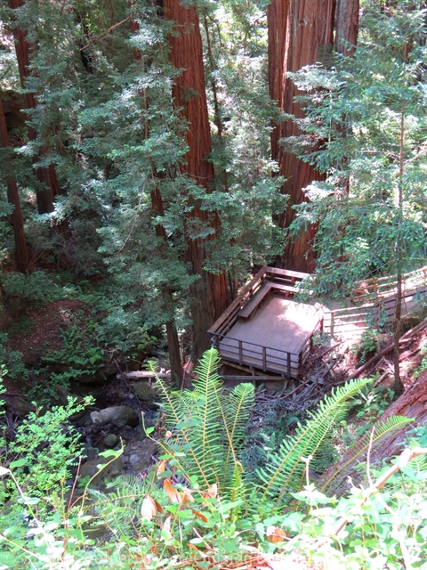
There is an observation platform two-thirds down Berry Creek Falls. This is the view from the top of the falls.
Enjoying Berry Creek Falls
While hiking we found this fine fellow, a California Sister butterfly.
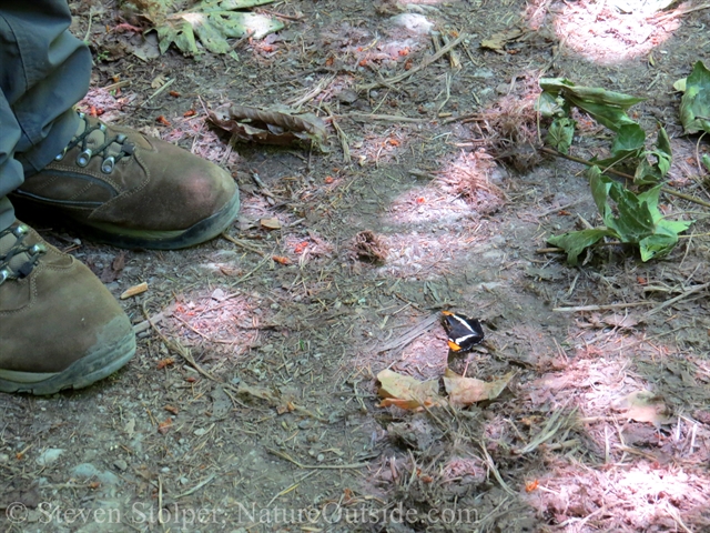
California sister butterfly
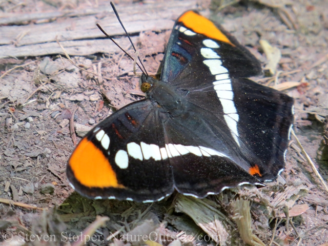
California sister butterfly
Happy Birthday
We stop for lunch at a sandy spot along Waddell Creek. It is one of our hiker’s birthday. So we improvise a cake from a snack purchased at the general store. We use one of my stormproof safety matches as a candle.
As we hike along, an old stump catches our eyes. Holes in the stump remind us of a human face. Apparently, an artist (vandal?) shares our opinion. He’s carved another face above the natural one.
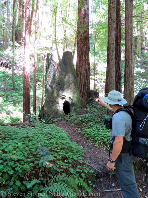
A face in the forest?
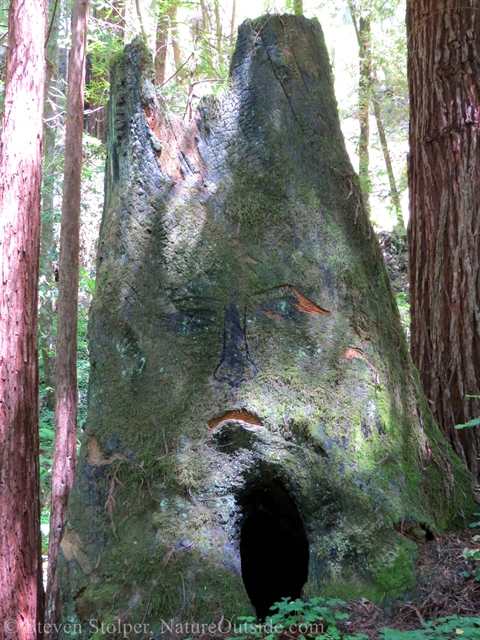
Someone carved a face above the “natural” one
The Ocean and Journey’s End
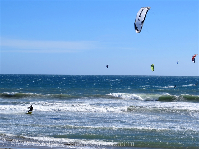
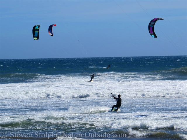
As the afternoon wears on, we continue our march to the sea. Finally, we break into the open with a clear view of the Pacific. What are those strange colorful specs in the sky? They swoop like birds but are much too big.
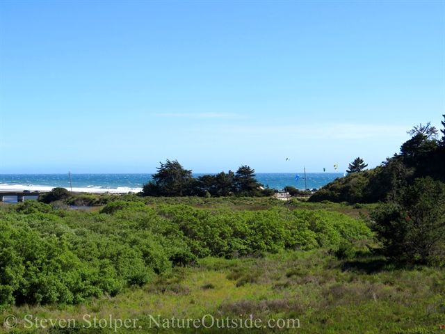
Our first view of the Pacific. Colorful specs in the sky?
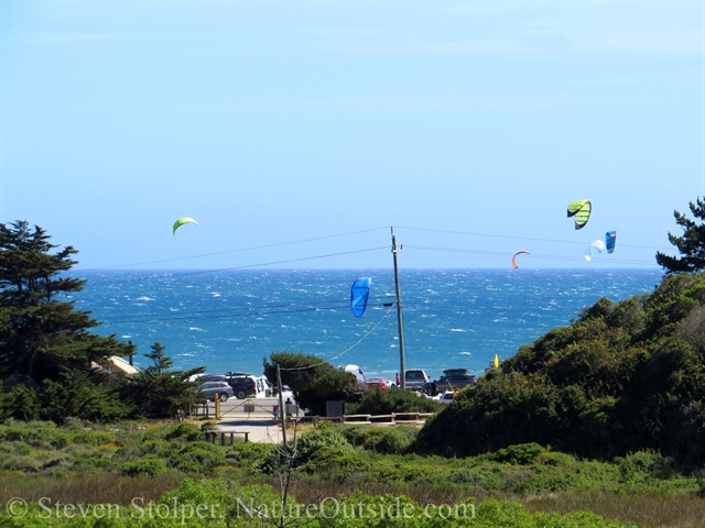
Kite surfers!
We assemble on the beach among dozens of kite surfers. The colorful wings create a huge fiesta in the sky. It’s like a victory parade in our honor! But at the same time, it’s strange to be among high-tech machines after spending days walking in the woods.
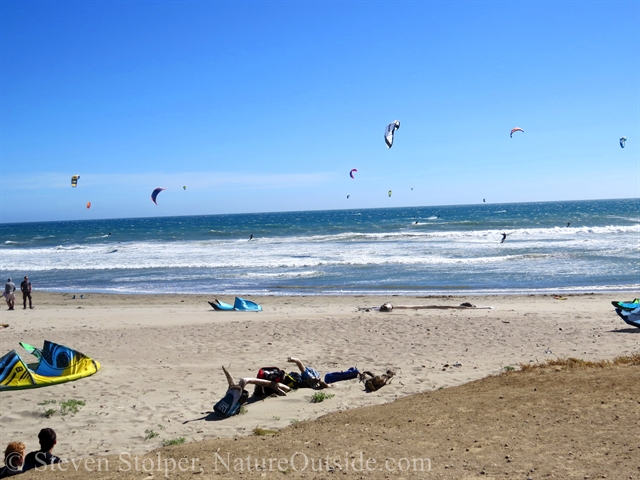
We assemble on the beach for a last hurrah! Arm-in-arm we plunge into the waves! Rangers Jeremy and Brandon lead the way.
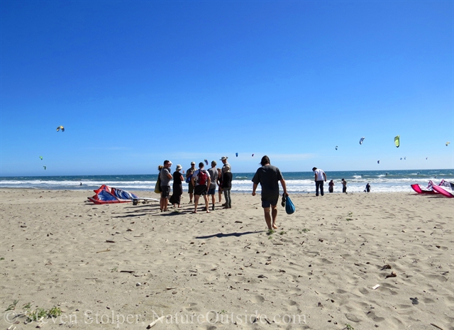
Our hikers assemble on the beach
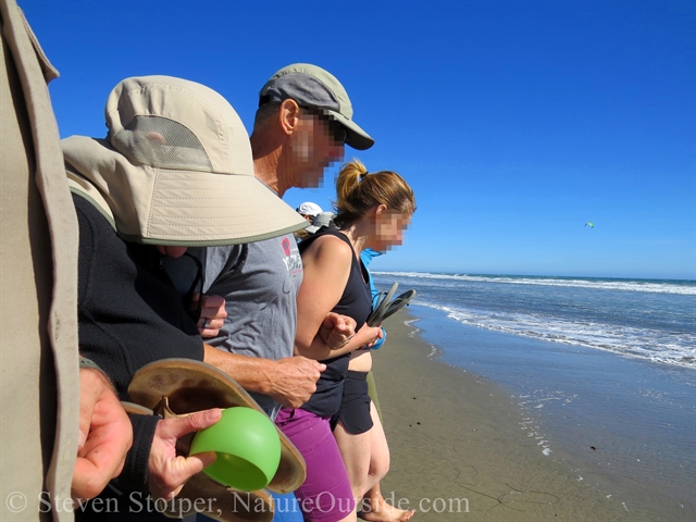
Here we go!.. 1… 2… 3!
The water is shockingly cold! It stings our legs and chills us instantly. But I don’t mind. My feet and spirit are rejuvenated by the frigid water.
It’s a fitting way to end our journey. And I will always remember these last four days. I’m grateful to our intrepid guides, and to the other hikers who made the trip so much fun.
I hope each of you gets to enjoy a similar journey sometime in the future.

Journey’s End!
Have you been on a meaningful journey? Share your experience in the comments section below.
Related Articles on NatureOutside
The High Sierra Loop – Introduction
For fun facts and useful tips, join the free Bushcraft Newsletter.


Leave a Comment