I have never been lost, but I was bewildered once for three days.
– Daniel Boone, when asked if he had ever been lost in the wilderness
Here is a tip for folding and carrying USGS Topo maps. I have been doing this for years and it works well for me.
Steps:
- Lay the topo map (map side up) on a flat surface
- Fold it in half (vertically) so that map-face meets map-face.
- One side at a time, fold each of the sides you just folded, back out again (in half). This effectively folds the map vertically into quarters, with the map facing outward on each “side”.
- You now want to fold the strip you created in half horizontally. However it is very important when you do this that the map side that is facing you has the name of the quadrangle at the top and bottom. You will be bringing a part of the map with its name to meet a part of the map with its name.
- Now, fold the map down on each side (almost like peeling a banana) so you can see the face of the map. This effectively folds the map into quarters horizontally.
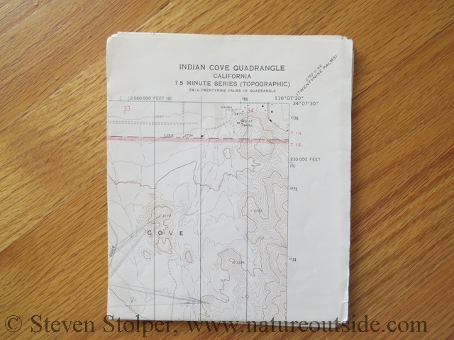
You end up with a rectangle that is approximately 5.5″ X 7″. No matter which side you look at, you see the name of the quadrangle. The map is very easy to orient and unfold. You can carry a stack of these and always tell instantly what quad it is before you unfold it.
Here are some pictures to illustrate the result:

Folded Topo Map – This is the finished product

Topo Map unfolds quickly and easliy

Topo map unfolded
Before I fold the map, I draw geographic north-south lines every inch or so. These lines make it easier to orient the bezel of my compass on the map when I compute a bearing. The lines I draw (in ink) are visible on the map pictures above. To account for magnetic declination, I either dial it into my fancy compass or place a line of tape on the back of the bezel of my plain compass. In either case, I align the north-south lines on my compass bezel with the north-south lines I draw on the map when I orient the map.
I hope you find this helpful. If you did, you may want to check out other articles in the Skills Section.


So helpful!! Map folding has confounded me up to this point. Thank you!
You’re welcome, Laura! I just folded maps this week for an upcoming trip to the Sierras.
you said “To account for magnetic declination, I either dial it into my fancy compass or place a line of tape on the back of the bezel of my plain compass. In either case, I align the north-south lines on my compass bezel with the north-south lines I draw on the map when I orient the map.”
How about you explain and demonstrate this technique. As far as I know magnetic declination is really only appropriate to center of your topo. Please clarify why this is a good idea?
James, this is an excellent question. Magnetic declination (also called magnetic variation) is the angle between magnetic north and true north, as observed from your current location. Compasses read magnetic north. Maps are drawn based on true north. So when orienting the map it’s necessary to perform the translation. It’s also important when shooting bearings. You need to translate the magnetic bearing from your compass to a true bearing in order to draw it on the map.
This is a good topic for a future article, and I will keep it in mind.